

Garreg Las [Twyn-Swnd]
Good walks are even better shared.
SN7720 : Rocks north of summit of Garreg Las
Trevor Littlewood Photo source
Overview
Garreg Las [Twyn-Swnd]
Garreg Las, standing at an elevation of 556 meters, presents a delightful challenge for those looking to explore the stunning vistas of the Brecon Beacons. With its notable prominence of 67 meters, it may not be the highest peak, but what it lacks in height, it more than makes up for in charm.
Geology
The mountain is formed from Old Red Sandstone, bringing with it a slatey character and an adventurous rocky terrain. As you make your ascent, you might even stumble upon some colourful fossils embedded in the rocks—if you’re lucky!
Routes
There are several paths leading to Garreg Las, but one of the most popular is the route starting from Ward's Road. This moderate trail covers approximately 6.8 km and typically takes around 2.5 hours to complete, with plenty of scenic views to catch your breath over. Aim for an early start on weekends, as it can get busy with fellow hikers.
Summit Features
The summit is crowned by a robust cairn that stands as a testimony to the countless adventurers who've made the trek. There’s also a delightful rocky outcrop that beckons weary hikers to take a break and enjoy the sweeping views.
Terrain
Expect a mix of rocky terrain complemented by patches of lush grass. Be mindful during or after rain, as some sections can be downright boggy. Proper footwear is essential to avoid turning your walk into a splash competition!
Views
Once you stand atop Garreg Las, your efforts will be rewarded with an extraordinary panorama of the surrounding landscapes. The majestic Pen y Fan dominates the northern horizon, while the rolling hills of the Black Mountains complete the stunning tableau. The best seasons to soak in this beauty are spring and autumn, with early mornings offering promising sunrises that are worth the early wake-up call.
Hazards
While the mountain can be welcoming, it’s essential to remember that the weather can turn on a dime. Familiarise yourself with the forecast, and be prepared for unexpected changes. And, of course, always carry a map and compass—your phone's battery might just decide to give up the ghost mid-hike!
Nearby Summits
Garreg Las shares its surroundings with notable peaks such as Pen y Fan (886 meters) and Corn Du (873 meters). If your legs are still feeling sprightly after conquering Garreg Las, consider tackling these giants next; they’re just a hop and skip away.
Access
To reach the starting point, you’ll find a small parking area along Ward's Road, but be warned—it can fill up quicker than a kettle! Public transport is a bit sparse, so it’s advisable to check bus schedules if you’re relying on it. The nearest town is Brecon, where you can refuel post-hike with a well-deserved cream tea.
Facilities
Brecon is equipped with various facilities, including cafés, restaurants, and restroom services, ensuring you can fuel up before and after your adventure.
History
As for its name, Garreg Las translates to 'Blue Stone', which might just be a nod to the hues of the rock around. Beyond its geological significance, the mountain is woven into local tales and folklore, making it a site of both natural and cultural interest.
So gear up, lace your boots, and venture towards Garreg Las—you won’t regret it!
Explore routes near Garreg Las [Twyn-Swnd]
Walks starting near this hill. Open a route to check its map, distance and full itinerary.
Aircraft Crash Site - Wellington Bomber and Vampire Jet (Black Mountain range)
View route
Usk Reservoir: Glasfynydd Forest and Dam Circuit
View route
Swansea Canal: Coed Gwilym Park to Pontardawe Aqueduct
View route
Pen y Fan via Corn Du from Storey Arms
View route
Route planning notes
These notes describe possible approaches. Check a route's map and access information when planning your walk.
Ward's Road to Garreg Las
A moderate ascent starting from the quiet lane of Ward's Road, offering splendid views as you climb.
Make a day of it, together
Find someone to share the walk with, or organise a day out along a route you like.
Photo Gallery
View all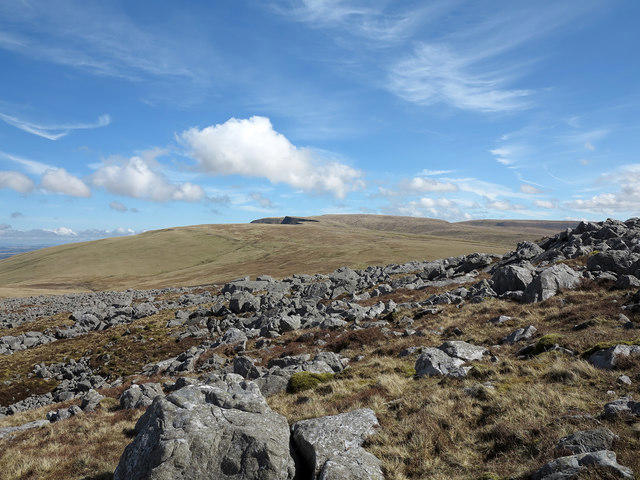 Photo could not load
SN7720 : Rocks north of summit of Garreg Las
Trevor Littlewood
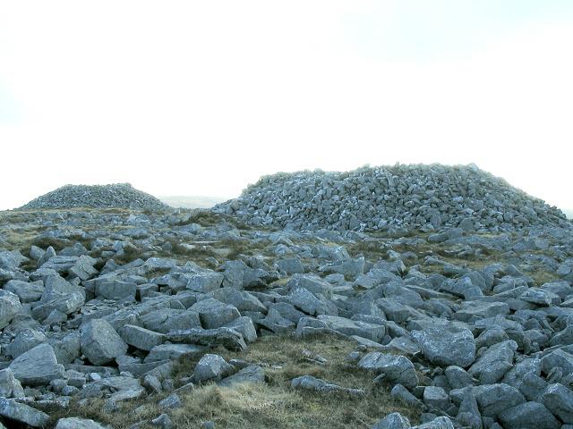 Photo could not load
SN7720 : Carnau'r Garreg Las
Nigel Davies
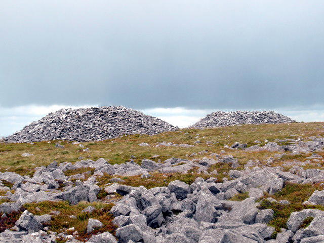 Photo could not load
SN7720 : Carnau'r Garreg Las
Alan Richards
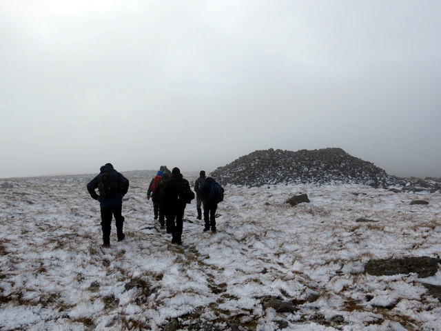 Photo could not load
SN7720 : Carnau'r Garreg Las
Alan Richards
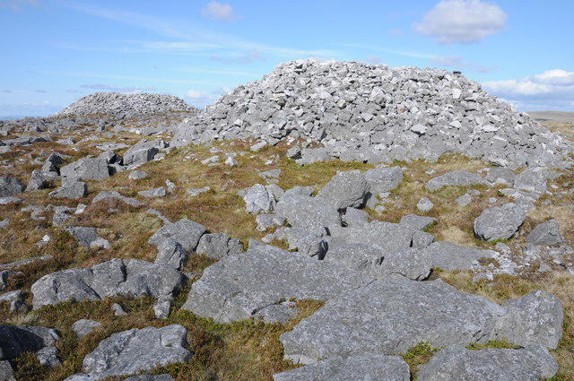 Photo could not load
SN7720 : Garreg Las
Philip Halling
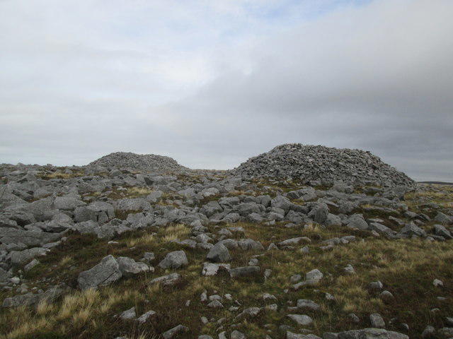 Photo could not load
SN7720 : Carnau'r Garreg Las Cairns 1 & 2
Adrian Dust
![SN7720 : Garreg Las [Twyn Swnd]](https://cdn.walkmates.com/gallery-images/b7e2c43fc90a46e5945b7cfd88aa89f4.jpg) Photo could not load
Photo could not load
SN7720 : Garreg Las [Twyn Swnd]
Rude Health
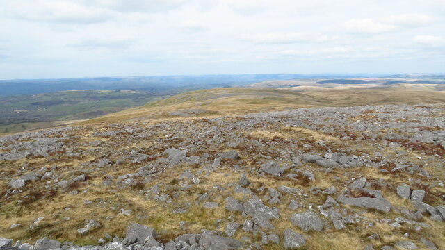 Photo could not load
SN7720 : On summit of Garreg Las - view towards Carreg Yr Ogof
Colin Park
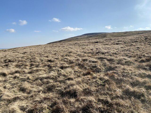 Photo could not load
SN7720 : Carnau’r Carreg Las
Alan Hughes
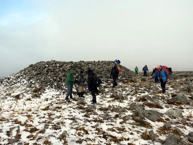
SN7720 : Carnau'r Garreg Las
Alan Richards
Hill facts and local notes
Classifications
Elevation
635m
2,083 ft
Prominence
94m
Coordinates
51.8681, -3.7771
SN777203
OS Map
160
Explorer: OL12W
At the Summit
A notable cairn marks the summit, providing a perfect spot for a well-earned snack or a selfie. The summit also features a small rock outcrop offering panoramic views.
Terrain & Geology
The mountain is predominantly formed of sandstone from the Old Red Sandstone period, which is over 400 million years old. Its rugged terrain offers an exciting challenge for geology enthusiasts.
Views & Scenery
From the summit, you can enjoy breathtaking views of Pen y Fan and the expansive Brecon Beacons, as well as the Black Mountains on a clear day.
History & Heritage
Name Origin
The name 'Garreg Las' translates to 'Blue Stone' in English, likely referring to the distinctive stone found in the region.
Historical Significance
Garreg Las is not just a natural feature but also a part of local folklore and heritage, often featured in tales of wandering spirits and local legends.
Getting There & Facilities
Parking
A small parking area is located along Ward's Road, but it can fill up quickly during weekends. Please park responsibly.
Public Transport
Public transport options are limited; the nearest bus service operates from Brecon town. Check local schedules for updates.
Nearby Facilities
Brecon offers a variety of cafés, restaurants, and toilets for hikers before and after their adventure.
Safety Information
Known Hazards
- Sudden weather changes can occur, leading to fog and rain; ensure you are prepared with appropriate gear and navigation skills.
General Safety Tips
- Check weather conditions before setting out
- Carry appropriate clothing and equipment
- Let someone know your planned route
- Take a map, compass, and GPS device
- Carry emergency supplies: food, water, first aid kit, torch
Hills
Some common questions about the hills answered
Are there group walks up Garreg Las [Twyn-Swnd]?
Many walkers use Walkmates to join or organise walks with others. You can check for group walks around Garreg Las [Twyn-Swnd] through the maps
Are there other walkers around Garreg Las [Twyn-Swnd]?
Activity varies by location and time, but Walkmates lets you see whether others have shared walks or shown interest in this area. Find other people through the walking friends search walking friends for Garreg Las [Twyn-Swnd] search or of course create your own walk for Garreg Las [Twyn-Swnd]
Can I organise a walk to Garreg Las [Twyn-Swnd]?
Yes. If there aren’t any walks listed already, you can create a walk and make it available for others to join.
If you're signed up to Walkmates, you can create a walk to Garreg Las [Twyn-Swnd].
How do I find a walk up this hill?
There are often multiple ways to walk this hill, depending on experience and route preference. Walkmates helps you explore walks and routes that others have shared.
Can I suggest a new route up Garreg Las [Twyn-Swnd]?
Yes. You can suggest or create routes to share with others. Walkmates focuses on the social side of walking, so routes are used to help people organise walks and explore areas together, rather than as detailed navigation tools or route libraries.
Other uses really appreciate knowledgeable walkers sharing their routes. Share your favourite route to Garreg Las [Twyn-Swnd] here
The is an error or something incorrect about this hill. How do I let you know?
We always strive to keep the information on Walkmates as accurate as possible. If you find an error, please let us know through the contact form and we'll aim to correct it as quickly as possible
Community Discussion
Comments
Location
![Garreg Las [Twyn-Swnd] location map](https://cdn.walkmates.com/hill-maps/hill-sources/2255/51.86808_-3.77706.png)
Grid reference: SN777203
View on OpenStreetMapOpens a map in a new tab, centred on the hill.


No comments yet. Be the first.